
アプリケーションの説明
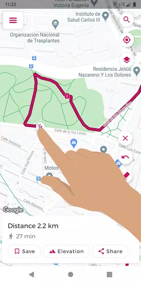
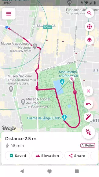
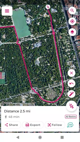
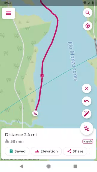
Easily plan your routes with Just Draw It! – Route Planner. Simply swipe your finger across the map to trace your path and see the total distance in real time. Ideal for running, walking, cycling, and other outdoor activities, the app eliminates the guesswork of where to go next. Save your favorite routes, import and export GPX files, and view elevation profiles for better planning. With tools like snap-to-roads and location search, routing becomes straightforward and efficient. Stop worrying about getting lost—explore confidently using Just Draw It! – Route Planner.
Just Draw It! – Route Planner の主な機能:
- \n
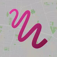
- Finger-drawn routes: Plan your path by simply drawing on the map with your finger.\n\n \n
- Import and Export GPX files: Modify pre-existing routes or share them with others.\n\n \n
- Accurate distance calculation: Measure exact distances between multiple points.\n\n \n
- Save favorite routes: Store your preferred routes for quick, one-tap access.\n\n \n
- Snap-to-roads: Correct and align routes to stay on roads and trails.\n\n \n
- Route elevation profile: View altitude changes for your entire route. \n
便利なユーザーのヒント:
- \n
- Before heading out, map and measure your route using Just Draw It! – Route Planner.\n\n \n
- Import existing GPX files and customize them to match your requirements.\n\n \n
- Share your custom routes with friends to explore together.\n\n \n
- Use the location search feature to quickly set your starting point.\n\n \n
- Inspect elevation profiles to anticipate steep climbs or descents. \n
総評:
Just Draw It! – Route Planner is the ideal companion for all your outdoor adventures—be it walking, running, cycling, or boating. Packed with intuitive features and precise distance tracking, planning your next journey has never been simpler. Download the app today and explore your surroundings with confidence!
Just Draw It! - Route planner のスクリーンショット
レビュー
コメントを投稿する
トレンドのゲーム
トレンドのアプリ


最新記事
もっと
『ギャラクシー・ディフェンス・フォートレスTD』勝利へのプロ戦略
Apr 30,2026
ニッケ2.5周年アップデート、リリースに迫る
Apr 30,2026
『ワールド・オブ・ゴウ2』がモバイルで配信開始
Apr 28,2026
『ソロレベルアップ: arise』が新しいSSRのウォーターハンターを追加
Apr 26,2026
『バトルフィールド6』予約開始と拡張コンテンツの概要
Apr 25,2026
ルノーのローラン・ガロッス・エスリーズ最終戦が5月24日に開幕
Apr 21,2026