

Application Description
The Development Plan Maharashtra app offers a convenient way to access and visualize city development plans across Maharashtra. This powerful tool overlays development plans onto satellite imagery, providing a detailed view for various users.
Key Features of the Development Plan Maharashtra App:
-
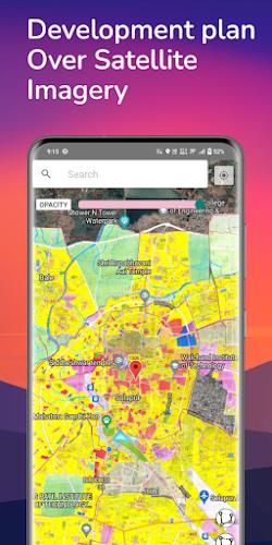
Interactive Development Plan Visualization: View development plans for multiple Maharashtra cities, overlaid on satellite imagery for a comprehensive perspective.
-
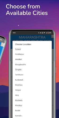
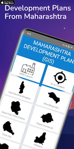
Extensive City Coverage: Access plans for major cities including Navi Mumbai, Pune, Kolhapur, and Nagpur, ensuring broad geographical coverage.
-
Customizable Mapping: Request tailored maps, village plans, and additional overlays for in-depth analysis of specific areas.
-
Versatile User Base: A valuable resource for developers, valuers, prospective homebuyers, and anyone needing detailed area information for informed decision-making.
-
Integrated Measurement Tools: Measure lengths and areas directly on the map, enhancing the app's practicality and utility.
-
Data Accuracy and Updates: Information is sourced from official government websites and documents; however, users should independently verify the latest information before making critical decisions.
Summary:
The Development Plan Maharashtra app is a valuable tool for anyone needing access to Maharashtra's city development plans. Its interactive visualization, custom map options, and measurement tools provide a comprehensive and user-friendly experience. While a helpful resource for developers, valuers, and prospective buyers, remember that the app is independent of any government agency, and users should always confirm details with official sources. Download the app now to explore Maharashtra's development plans.
Development Plan Maharashtra Screenshots
Reviews
Post Comments
Trending Games
Trending apps


Topics
More
Best Tools for Home Improvement Projects
Popular Hypercasual Games Online
Top Apps for Editing and Playing Media on Android
Exciting Casino Table Games for Android
Top Offline Adventure Games for Solo Play
Fun Educational Games to Learn and Play
Top Card Games to Play Online
Lifestyle Management Apps for Modern Living
Latest Articles
More


Trails in the Sky 1st Chapter Launches
Apr 18,2026
Arkham Horror Card Game: Smart Buying Guide
Apr 15,2026