

Application Description
Embark on an unparalleled journey into the geological wonders of Mexico with GeoInfoMex, your ultimate guide to geoscientific exploration. With this powerful app, you'll unlock a treasure trove of knowledge, from geological-mining and geophysical data to geochemical maps and details on mines, beneficiation plants, and awe-inspiring rocks. Dive deeper into Mexico's agrarian landscape with insights from the National Agrarian Registry and marvel at the beauty of the nation's protected natural areas under CONANP's stewardship. Stay vigilant with real-time seismic updates from SSN and IG-UNAM, and tap into vital hydrological data from Cencas to understand Mexico's water resources. GeoInfoMex is your gateway to uncovering the geological secrets of Mexico.
Features of GeoInfoMex:
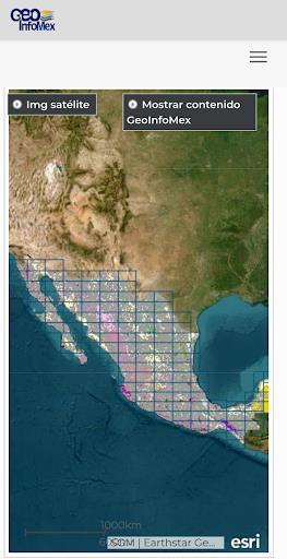
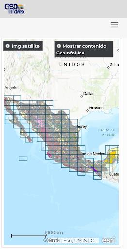
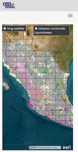
Comprehensive Geological Information: GeoInfoMex is your go-to source for a vast array of geoscientific, geological-mining, and geophysical data across Mexico. Delve into detailed maps and datasets covering geological-mining activities, geophysical surveys, and geochemical analyses.
Mining and Rock Data: Explore the rich tapestry of Mexico's mining heritage and geological marvels. GeoInfoMex provides in-depth information on the location, features, and specifics of mines, beneficiation plants, and significant rock formations throughout the country.
Land Ownership Details: Gain a clearer picture of Mexico's agrarian landscape with data from the National Agrarian Registry. Understand land ownership, boundaries, and key agrarian nuclei (ejidos) to better appreciate the country's land use and distribution.
Protected Natural Areas: Discover the beauty and importance of Mexico's natural reserves with data from the National Commission of Natural Protected Areas (CONANP). Whether you're planning an eco-tourism adventure or focused on conservation efforts, this feature offers essential information on Mexico's diverse ecosystems.
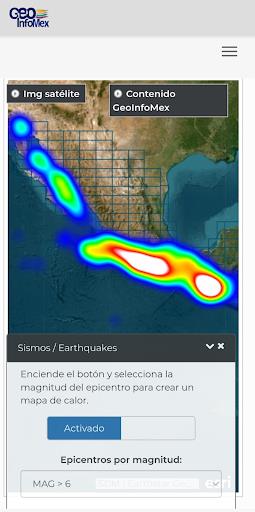
Earthquake Monitoring: Stay informed and safe with real-time earthquake data from the National Seismic Service (SSN) and the Institute of Geophysics at UNAM (IG-UNAM). GeoInfoMex keeps you updated on seismic events, their magnitude, and locations, helping you stay ahead of potential risks.
Hydrological Data: Access crucial hydrological insights from the National Water Commission (CNA). With information on Cencas hydrological reports, including water resources, river basins, and water quality, you'll be equipped to make informed decisions about water management and conservation.
Conclusion:
Whether you're a seasoned geoscientist, a dedicated researcher, an environmental advocate, or simply fascinated by Mexico's geological tapestry, GeoInfoMex is the essential app that delivers accurate, comprehensive, and up-to-date information at your fingertips. Don't wait—download GeoInfoMex now and start your journey into Mexico's enthralling geoscientific world!
GeoInfoMex Screenshots
Reviews
Post Comments
Trending Games
Trending apps


Latest Articles
More


World of Goo 2 Now Available on Mobile
Apr 28,2026
Solo Leveling: Arise adds new SSR water hunter
Apr 26,2026
Battlefield 6 Preorders and Expansions
Apr 25,2026
Trails in the Sky 1st Chapter Launches
Apr 18,2026